Flytomap Nautical Charts GPS Specifications
|
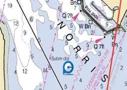
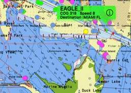
Detailed nautical & topo maps.
Beautifully designed from the ground up (and the sky down), FlyToMap will change the way you see the world.
Map elements are vector based, so graphics and text are incredibly detailed even when you zoom all the way in and panning is smooth. Tilt and rotate to view an area, and everything remain consistent.
"This App offers the full access to the FlyToMap cartography with the in App purchase business model of Apple.
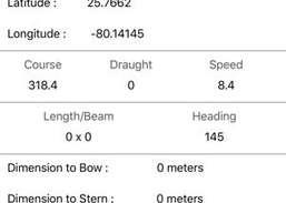
You have all functions of the FlyToMap all in one and the display of the on line data.
You can then purchase all the maps: Marine, Travel, Parks, Lakes etc.. at reasonable cost for using them offline."
The Malayalam Bible made for iPad; It creates a real Holy Book experiance. This contains both New and Old testaments and created in a sepia colored...
Present live maps and satellite imagery from any iPad to a TV or projector! MapProjector lets you create unlimited maps with labeled landmarks and...
Get the App. Get the Map. Avenza Maps is a powerful, award-winning offline map viewer with a connected in-app Map Store to find, purchase and...
MAIN FEATURES OF ROUTE 66 NAVIGATION: turn-by-turn directions for Route 66 westbound as well as eastbound.
Thailand Map is a professional Car, Bike, Pedestrian and Subway navigation system.This app will help you determine your location,guide you to...