North Carolina Roads Traffic Specifications
|
Traffic Reports & Cameras.
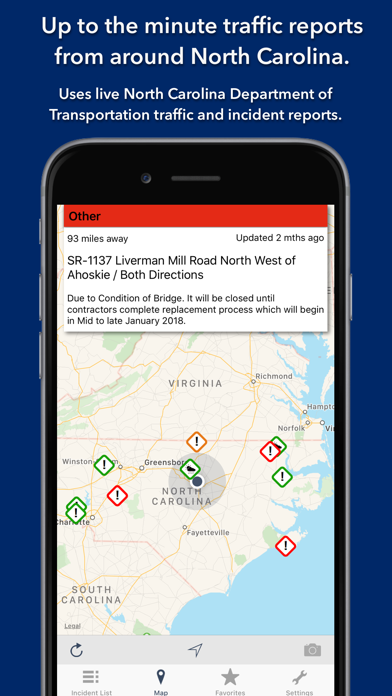
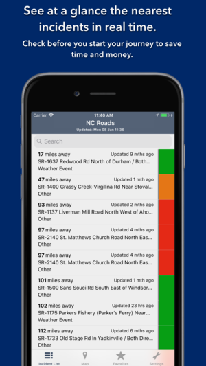
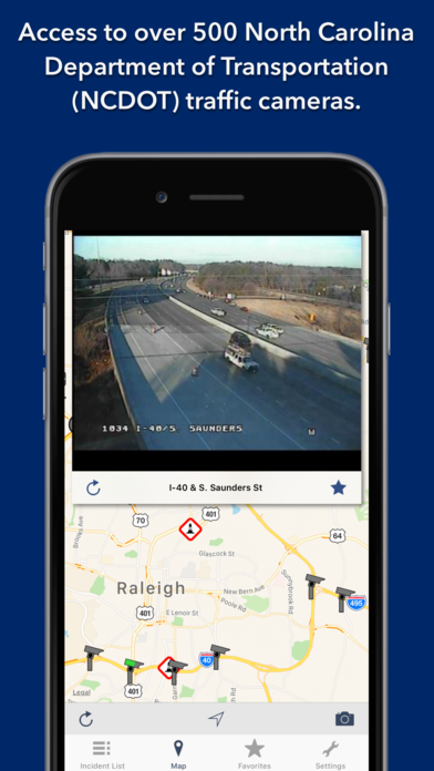
Live traffic reports and cameras for North Carolina. Save your favorite cameras for quick access. The January 2018 release optimises for iOS11 and the iPhone X.KEY FEATURES:MAP VIEW- Shows current incidents and traffic cams.- Each incident is color coded as well as being represented by an icon showing the incident type.- Clicking on an incident displays more detail right there on the map.- The map view can also show live traffic camera images.LIST VIEW- Shows current incidents in order of distance from your current location (closest incidents are shown first).- Each incident is color-coded to indicate the severity of the delay.- You can quickly see the distance the incident is from you, the road name and the type of incident.- The detail view shows the description together with a map showing the location.- Full search functionality, works across both the list and map views.TRAFFIC CAM FAVORITES- Save your favorite cameras for quick access to see how clear/congested your usual routes are.TODAY WIDGET- Shows at a glance the nearest current traffic incidents without launching the app.PERSONALISE- Toggle traffic information on the map.- Toggle auto refresh of camera images (will refresh every 10 seconds).- Toggle always show map on app launch.- You can configure which incidents are displayed according to the severity of the delay caused.- Kilometres or Miles setting.Optimised for all iPhone and iPad models; fully tested on iOS9, iOS10 and iOS11.CONTACT- Email me for feature requests/bug reports etc. I would love to hear from you!Data courtesy of the North Carolina Department of Transportation .
Kentucky 511 is the Kentucky Transportation Cabinet's (KYTC) official traffic and traveler information resource. The Kentucky 511 app provides...
An app designed to help out those traveling along the Erie Canal by showing the Boat Launches, Locks, Lift Bridges, and Guard Gates along the...
Through Car Navigation: GPS Maps navigation has become very easy and efficient as you can search for city-any location map and watch the places...
Use maps Area Calculator to draw an area on a map and find out the measurement of the enclosed area.
|
|
|
|
|
|
|
|
|
|
|
|
|
|
|
|
|
|
|
|